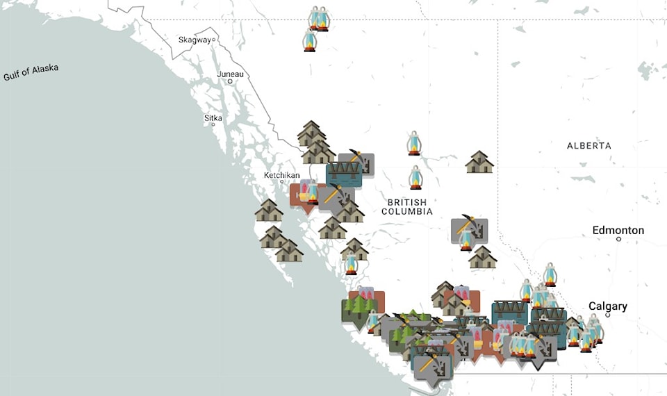
A new online map displays 76 significant industrial heritage sites in B.C.
Prepared by Heritage BC, the sites range from coal mines and pulp mills, to ghost and company towns riddled across the province.
It helps trace the historical industrial activities that positively and negatively shaped livelihoods, community growth, economy, and B.C.'s environment.
There is also an accompanying document that provides context to the map because communicating the history of industry in B.C. is an enormous task.
The sites were submitted by communities, organizations and individuals across the province. The submissions were then reviewed by a committee of industrial heritage advisors from Heritage BC.
"We were very happy with the support and enthusiasm we heard from across the province in the nomination process," said Kirstin Clausen, executive director of Heritage BC. "The number and diversity of nominations clearly show the impact that industry has had on communities all over the province."
The map represents a wide range of industries, including commercial and manufacturing, power, transport and infrastructure, food and drink production, forestry, pulp and paper, and non-renewable resource extraction and processing.
Heritage BC acknowledges the map and document only scratch the surface of industry in B.C. Rather, they attempt to set the scene and encourage the viewer to consider both the positive and negative ways in which industry has shaped the province, from economic growth and urbanization, to the colonization of Indigenous peoples, and deforestation.
A key detail is that this map only includes industrial activities that occurred after the second industrial revolution, which was from the 1860s to 1950s.
The document does note an example of pre-industrial revolution industrial activities in B.C., however.
The land of the Secwépemc and Nlaka’pamux Nations, which is now known as the Arrowstone Hills Toolstone Quarry near Cache Creek, was used for 11,000 years to gather and process lithic materials during the Stone Age. This was close to several other Neolithic toolstone sites in this region as well.


